Appalachian Trail, By the Numbers

Posted on October 5, 2011

Greetings from Boston! One week ago, we reached the summit of Katahdin, and that already feels like a very distant place. Since then, we have traveled from Millinocket to Augusta, Maine, where we spent a wonderful weekend with Kelsey G. and others. Then we hopped on a bus to Boston, where we’ve been crashing (thanks, Emily and Joel) for three days now. Our main activity has been eating any and all types of food that weren’t available to us on the trail, and all this time with friends and food has helped us get happily reacclimated to civilization.

d'awwww

Awwwwwww…

Looking back on our time on the Appalachian Trail, so many sights and stories come to mind. And so do some numbers. It’s such a long journey, that it’s hard not to quantify certain parts of it. Everyone hikes the trail in their own fashion. Here’s how it went for us:

2,181 – Number of miles hiked on the A.T.
169 – Number of days on the trail
20 – Number of “zero” days (days off)
14.6 – Average daily mileage (not including “zero” days)
25 – Number of miles on our longest day (in Shenandoah National Park, VA)
1.8 – Number of miles on our shortest day (into Gorham, NH)
14 – Number of states we walked in (GA, NC, TN, VA, WV, MD, PA, NJ, NY, CT, MA, VT, NH, ME)
3 – Number of pairs of boots that we each wore through
515,000 – Total number of feet gained in elevation (“It’s like climbing Everest 17 times.”)
310 – Approximate number of thru-hikers or section hikers we met
7:1 – Gender ratio (Men: Women) among hikers we met
9 – Number of days in our longest stretches without showers
21 – Number of books read
12 – Number of bears seen
1 – Number of rattlesnakes seen
0 – Number of moose seen
Countless – Number of rabbits, snakes, frogs, grouse and deer seen
Another important aspect of our experience was the food we ate in trail towns along the way. Above all, the crown for best vegetarian food goes to Sunnybank Inn in Hot Springs, NC! Thanks, Elmer!
For the time being, we are glad to be done hiking, and our sore joints are thanking us for the rest. But we know that we’ve been bit by the “hiking bug,” and it’s only a matter of time before the trail calls us back again…who knows, maybe in a few years, we’ll be blogging about our adventures on the Pacific Crest Trail…
Until then, happy trails to all!
Love,
Lara and Zack

The End

Posted on September 28, 2011

Trail complete!

Trail complete!

After 169 days of hiking (5 months and 15 days), we reached the end of the Appalachian Trail! At 10:00am on Wednesday, September 28, we climbed to the top of Baxter Peak on Mount Katahdin – screaming, giggling, and not believing our eyes.

After leaving Monson, Maine, we completed the “100-mile wilderness,” which brought us many broken bog bridges and a few rainy days, but overall we had a wonderful time, and unseasonably warm weather. The nine-day stretch without civilization (or a shower!) was an appropriate and epic way to end our long trek. The wilderness plopped us into Baxter State Park, where the infamous Mt. Katahdin awaited us, looming in the distance.

Our summit day was gorgeous and clear – a “Class 1” day in Baxter-speak – and we made the ascent with old friends. It was a pure rush of joy and confusion, which we’re still in the midst of processing…and probably will be for a while to come.

The climb up Katahdin is no picnic; it’s commonly referred to as the hardest climb on the whole trail, and it’s certainly the longest. But, the adrenaline rush that we felt going up made the rock-climbing and gymnastic aspects of it seem enjoyable. Coming down, on the other hand, was not quite as fun, but we were still grateful for good weather and incredible 360-degree views.

We’re now resting up in Millinocket, Maine before traveling around the Northeast for a week or so. Lots and lots to think about and to be thankful for. We’re thrilled to have finished, and are curious to see what happens next.

Mount Katahdin, hello.

Mount Katahdin, hello.

Thanks for following us and sending us encouragement along the way. Stay tuned for one final blog post, which we have decided to call “Our Hike, By the Numbers,” an exciting statistical analysis of our trip. Ooo!

Love to all, and happy trails!

Lara and Zack

Entering Hundred-Mile Wilderness

Posted on September 20, 2011

Almost there…

Hazy Maine.

Hazy Maine.

From Zack:

“Howdy,” from Monson, ME, the last trail town before the hundred-mile wilderness, Mt. Katahdin, and the end of our hike. We’ll be heading into the next section, one of the wildest and most remote on the trail, with nearly seven days worth of food. Hoping to find the proper balance between enjoying the last week of this journey and remaining disciplined enough to achieve our goal atop the big mountain.

From Lara:

We entered Maine over a week ago now, and we’re more than half-way done with the 281-mile state. We have had great weather over some gorgeous mountains (we’ve decided already that Maine is the “best” state on the trail), and some bad weather over some gorgeous mountains too (snow flurries – who needs ’em?). We’re about to embark on an all-you-can-eat breakfast in Monson, then organize our food supply (more than we’ve ever carried) and hopefully put in a few miles today; it is, after all, the only day in the next week without a chance of rain. But, we’ll handle it…as they’ve said from the start: “No rain, no pain, no Maine!”

Land o'lakes.

Land o’lakes.

Keep an eye out for an enormous and more informative post in the next two weeks, and as Zack says, “If you’ve got the time, please send us good vibes!”

Maine

Posted on September 16, 2011

Maine. Hard to believe we started walking 157 days ago. Tomorrow, if all goes according to plan, we’ll complete our 2,000th mile. I’ll save the really sappy stuff for our final blog entry post-Katahdin, but we’re already feeling a mix of nostalgia, elation, weariness and appreciation as we scurry through our final two weeks here in the great North.

"The way life should be."

“The way life should be.”

We last wrote from Gorham, NH. Since that time we’ve traversed some of the most strenuous miles on the trail. On one particularly rough day we made it only 12.5 miles in nearly 11 hours of walking. Tomorrow we’ll cross over the Bigelow range, our last “big” mountains until the end of the trail. Doing our best to retain focus and good spirits in this last stretch, despite the first inklings of cold weather (flurries and ice this morning at 4,000 ft. before Stratton).

See you soon,

Zack (and Lara)

The White Mountains

Posted on September 7, 2011

What a week it’s been! I apologize for all of the drama and confusing goings-ons in the previous blog. Last you heard from us, we thought we were stranded in Glencliff, NH “until further notice,” or whenever the USFS decided to open the White Mountain National Forest. Along with our fellow thru-hikers, we melodramatically hypothesized that this meant we would be stuck in Glencliff for many days, potentially jeopardizing our trek. But! We awoke the following morning to find that the forest had been opened that very day.

Welcome to the Whites.

Welcome to the Whites.

Glencliff to Gorham, NH

Thrilled, we got a late start after sleeping in, and headed up Mount Moosilauke – our first real White Mountain, and our first hike above treeline. The trail was flooded and swampy at parts, but it was a beautiful day, and we didn’t seem to mind. It wasn’t until we had to hike down the infamous backside of Mt. Moosilauke that we had a bit of a wake-up call as to how hard the upcoming sections would be. (We had been warned, but somehow it’s hard to believe all of the hype until you’re there.) Crawling down the mountain, alongside a waterfall, I took a tremendous spill – a sign of many more to come. We got into camp very late that night, and realizing how slow our pace had become on these strenuous miles, we reassessed our schedule for the upcoming section.

IMG_6083

Thru-hikers often have a “love-hate” relationship with the White Mountains. First of all, the “love:” they are stunningly beautiful, and much of the hiking is above treeline and over 4,000 feet, which is unlike anything we’ve encountered on the trail thus far. On a clear day, you can see for miles, over mountains and into the valleys below. For the “not-so-much-love” part, the terrain becomes incredibly difficult (more climbing and crawling than hiking) and at times treacherous, your pace slows (from 2-3mph to 1-2), the weather can change at any minute and become dangerous (Mt. Washington notoriously has “the worst weather in the world”), and because of the mountains’ popularity, the places to stay are limited to expensive huts and pay campsites (thru-hikers are a thrifty bunch, so this is a particularly rough adjustment). Overall, we’ll lean towards the “love” side of things, but many bruises and rain storms later, we certainly can see both sides of the coin.

Franconia.

Franconia.

Our first days in the Whites, we had excellent weather. Our views as we hiked along Franconia Ridge and up Mt. Lafayette were spectacular. We were on an hiking high, until we went up Garfield Mountain, where dreams go to die. Somewhere up the steep climb and down its vertical waterfall descent, my quad began to hurt very badly, and we stopped for the night at Galehead Hut after a slow and painful afternoon. If you’re lucky, the huts offer a few hikers the opportunity to work for stay and food each night. We were able to stay at three different huts, and ate lunch at most of the others, making it possible for us to make it through eight days of hiking while only carrying four days of food (also a good thing because the road where we had planned to get out to resupply had been washed out in the hurricane and was closed).

By day four in the Whites, we planned to get off the trail to rest my leg, which didn’t seem to improve. Yet, when we got to the road where we planned to get off, we changed our minds, I took some Advil, and we pushed on. At first, that seemed like a crazy thing to do, but ultimately, it was the right decision – we were able to get two more days of amazing weather because of it, and my leg seemed to heal with time.

Approaching Lakes of the Clouds hut.

Approaching Lakes of the Clouds hut.

We made it to Lakes of the Clouds Hut on Saturday night; located at the base of Mt. Washington, the highest peak in the northeast, it is the biggest and most popular hut in the Whites, packed every night of the week. We slept on the kitchen floor and headed out early for a clear morning on the summit. At 6,288 feet, Mt. Washington is something to behold, and is perhaps most famous for its high wind speeds (highest ever recorded) and horrible weather. Thankfully, we experienced neither, though once we descended, the mountain was once again shrouded by clouds.

Veggie show's some tenacity.

Veggie shows some tenacity.

It’s hard to describe the beauty that we witnessed. We will post pictures when we can, and hopefully that will better convey it. The last two days have been on-and-off raining, causing many spills and slow miles, but we’ve persevered, met up with some old friends (Chimp, Domino, Whiskey and Holler!), made it to Gorham, New Hampshire, and found a cozy place to take a “near-o” at the White Mountain Hostel.

Chimp at the end of a long day.

Chimp at the end of a long day.

We have less than 300 miles left on the trail, and less than 20 until we reach Maine. We estimate – and hope – that we will reach Katahdin in just over three weeks. There are many variables, and the next 150 miles are considered to be very difficult and rugged, so we’re not out of the woods yet, so to speak. But we’re savoring our time with our fellow thru-hikers and trying to make the most of our last month.

Wish us good weather and less bruises!

Love to all,

Lara (and Zack)

Hurricane Irene

Posted on August 28, 2011

When it rains, it pours! And…the trail is closed. When Zack wrote this blog early yesterday at a coffee shop in North Woodstock, we had no idea that a few minutes away, the cabin where we had stayed with Ry and Vanessa was flooding, due to the rains brought on by Hurricane Irene and the overflowing nearby river. When we got back after a trip to the movies, we were shocked to see the cabin complex underwater. Ry ran into the cabin to rescue Fern, their dog, and as the water receded, we were able to go in and retrieve our possessions. As nomads these days, it was a strange feeling to not know whether our only belongings would be salvageable, but we are grateful to report that after a trudge through the water, we were able to gather it all – except my phone, which drowned when the waters rose – from the sopping cabin.

Ry and Vanessa dropped us back in Glencliff, NH, where our trail crossing is, but we had to take a roundabout way because so many roads had flooded. Now, we are at Hikers Welcome Hostel, and though it’s a beautiful day today, the water levels everywhere are incredibly high, so there’s no hiking today…or maybe even any time too soon. The USFS has closed the White Mountains – and all sections further north – until further notice. Apparently, that’s never happened before. We’re hoping that the USFS will be able to open the trail soon, and that our dream of finishing the trail this year will be a reality.

Vermont gorge.

Vermont gorge.

We’re ready to get moving (feeling restless), but we don’t have much of a choice. We also discovered that Zack’s pack is broken, so he went on a journey back to Hanover, to get a new one. We’re very grateful that things weren’t worse, humbled by the news coverage of people, homes and towns (even ones we were in as recently as a few days ago) washed away. We’re staying positive too, and as my Dad says: “You two just keep making memories!”

Here’s what Zack wrote yesterday, pre-Irene: We’ve completed twelve states now, and have two of the roughest, most rewarding left to go. New Hampshire has to be one of the most talked-about states. One section hiker, heading southbound, grimaced when we asked about the terrain to come, then cackled, “Enjoy NEW HAMPSHIRE! AHAHAHAHAHA.” We’ve heard dozens of times now that the Whites are unlike anything else we’ve seen on the trail. Our plan? Take the challenges in stride like we have for the last 1700+ miles and enjoy every minute of it.

Manchester, VT to Mountain Meadows Lodge (near Killington, VT)

We left off in Manchester Center, VT at the Green Mountain House hostel. From there we caught an excellent view from a fire tower on top of Bromley, got our boots soaked in pond run-off and narrowly evaded a boisterous electrical storm. The northern section of Vermont is a flowing, needle-covered, primrose path, adorned with spruce and pine. We built a Cairn on White Rocks and made friends with some Czech students on a “genius,” whirlwind trip around the U.S. Then–surprise!–we met up with the most lovable of fellows, Matt S., near Clarendon Gorge for a visit to Camp Sangamon (“oh Sangamon, oh Sangamon, oh Sangamon our home!!!”). He even took us to ice cream. What a guy.

We were able to dodge two thunderstorms in the same day, one on top of Mt. Killington, another on the northern face. Passed Maine Junction, where the Long Trail diverges, after 100 or so miles, from the AT, and turned due East towards a little slice of heaven. Situated on Kent Pond, the Mountain Meadows Lodge proved to be a glorious afternoon respite for two weary hikers. Bill and Co. took us in for the evening, even though they were shampooing the carpets. We loved it there, and can’t wait to go back.

Mountain Meadows to Hanover, NH and Beyond

Happy and full, we left Mountain Meadows for our last Vermont section. The “flatish” terrain turned out to be a real roller coaster of ups and downs–some of our toughest days in the state. Our good friend Bruce, prescient with detailed elevation maps in hand, sent us off one morning with a shout of, “YOU’RE GONNA CLIMB TODAY, BOY!” Alas, even downhill segments felt uphill on our way to Hanover. Lucky for us, the home of old Dartmouth is chock-full of motivating temptations for thru-hikers: Free bagels at the Bagel Basement. Free Pizza at Romuntos. Free Coffee at the Dartmouth bookstore. Strangers upon strangers offering their apartments for nights on end. We found a nice balance between asceticism and indulgence, feasting at the Bagel Basement and food co-op, getting our chores done, and still making 17 miles that day. Hanover definitely makes our list of “must-go-back”s. (Our weather timing was not quite as good that day though; after nervously awaiting storms all day, we stayed dry through 17 miles, until we got poured on in the last five minutes of our hike.)

Bruce says "You're gonna climb today, boy!"

Bruce says “You’re gonna climb today, boy!”

Hanover, NH to North Woodstock, NH

Two more big days over Smarts Mountain and Mt. Cube gave us a taste of what’s to come: long, rocky, rooty, slick climbs with incredible views at the top. Can’t wait to hit the trail again with Mt. Moosilauke (hopefully) on Monday. The weathermen say we’ve got some beautiful weather in store for the week, so we’re hoping they aren’t pulling our leg this time.

Less than 400 miles to go.

Zack and Lara

Vermont

Posted on August 18, 2011

We made it to Vermont! Now, that seems really far away from where we started. Since our last post, we have had some of our best trail moments, and – thanks to the near-constant rain – a few of our not-so-best trail moments. But, we are now refreshed and “caloried-up,” as they say in hiker-speak, in Manchester Center, VT at what might just be the best hiker hostel evah, Green Mountain House.

Boots drying at the Green Mountain Hostel.

Boots drying at the Green Mountain House.

In lieu of keeping things interesting, and not having to write a novel every time we do a blog entry, we are ditching the day-by-day format and going for a more free-form style. So, here’s what has happened to us since we left the comfort of the Berkshires back in Massachusetts…

Great Barrington to Dalton, MA

After stuffing ourselves silly with Cousin Eddie and Mickey, we got back on the sunny trail with heavy packs and full stomachs. Massachusetts continued to impress us with some amazing vistas and wonderful shelters. We had heard about the wonders of Upper Goose Pond Cabin, an Appalachian Mountain Club facility, operated by a volunteer caretaker, and had planned our mileage around getting there with enough time to spend a leisurely afternoon on the pond. The picture-perfect pond atop the mountain made for an amazing time, indeed. We took a canoe out and paddled the perimeter of the pond, and cooked our dinner on a real stove. And, in the morning (this is the stuff of legends among thru-hikers), the caretaker makes all-you-can-eat pancakes! And coffee! Needless to say, this was one of our favorite places on the entire trail.

The next day, we stopped for lunch at a blueberry farm along the trail and picked ourselves a pound of fresh berries. Our guidebook referred to this farm as the residence of the “cookie lady,” which seemed curious since clearly it is a blueberry farm. But then…they brought us a basket of freshly baked cookies, and we happily understood the nickname. Energized, we hiked a long day into Dalton, where we stayed with Tom Levardi, who, for 31 years, has welcomed hikers into his home for laundry, a shower and a cushy floor to sleep on. And we thought the cookies were as good as life could get!

Blueberry picking!

Blueberry picking!

Dalton to Adams, MA

After stopping at the local diner on the way out of Dalton (for “grilled” coffee cake – which means, coffee cake + more butter), we hiked a short day to the next town over, Cheshire, MA. There, we met up with Emily C., one of our most favorite people. She had driven all the way from Boston to spend the day with us, and we were thrilled to be with her. First order of business, of course, was finding some place to eat second breakfast, so we made our way to the little town of Adams, and stuffed ourselves on the biggest blueberry pancakes you’ve ever seen. (At the end of this trip, I think blueberry pancakes will rank #1 on our list of “Items most ordered along the A.T.”)

After running some errands and checking into Mount Greylock Inn, a charming bed and breakfast, we went to the Berkshire Mall, where destiny called and we finally saw the last Harry Potter movie! Our viewing was followed by a delicious dinner of pizza and ice cream in the mall food court, featuring in-depth discussions of the series. (What does it mean for our generation that the series is now over? Does evil cease to exist in Harry’s world now that Voldemort is vanquished? And, more importantly, why didn’t they film Ron and Hermione’s kiss from a better angle? Etc…)

The next morning, we returned to Miss Adams Diner for more pancakes (I surprised Zack by sneakily ordering some for us while he had gone to the restroom), and then Emily dropped us back onto the trail and headed back to Boston.

Adams, MA to Manchester Center, VT

We hiked up Mount Greylock in a thick fog, and unfortunately, when we reached the top, we had no view at all. We’ve added the mountain to our list of sites to come back and see in better weather because we’ve heard it’s a view not to be missed. We had only planned to do a 16-mile day to a campsite, but as we got closer, we ran into a friend who heard that big rain was on its way, and advised that we aim for the nearest shelter instead. That’s how we ended up in Vermont a day early, and that’s when the rain began…

A break in the rain - view from VT fire tower near Manchester.

A break in the rain – view from VT fire tower near Manchester.

Unfortunately, our first two days in Vermont featured a near-constant downpour and chilly temperatures. We were able to slog through it, and keep some of our clothes dry, but the infamous “Vermont mud” made hiking a bit slow and sloppy. The trail at times looked more like a river than a trail. By day three, the skies cleared and we got to see more of the Vermont we had been expecting – the Green Mountains finally emerged through the fog, and the bright sun began to dry out our drenched selves. We also crossed the 3/4-mark, and felt a sense of accomplishment in that.

This morning, we hiked a quick 2.8 miles into Manchester Center, where we spent the morning eating (more pancakes!) and running errands in the outlet-oriented town. Now, we’re at Green Mountain House – a true home for hikers more than a hostel – with a computer, TV, beds, shower, laundry, kitchen and freezer (we get our own pint of Ben and Jerry’s; this is Vermont, after all!).

It’s hard to believe we’ve made it to our twelfth state. More than 500 miles remain, which feels simultaneously like a long way to go, and not much in comparison to what we’ve done. We’re feeling grateful to still have our positive attitudes in tact (unfortunately, it’s becoming rarer and rarer to see North-bounders with smiles on their faces) and looking forward to new boots on our feet!

Love to all,

Lara (and Z)

Massachusetts

Posted on August 9, 2011

In Massachuuuusetts. In Massachuuhu-setts. Hey everyone. Sorry it’s been forever since we last blogged. It’s just…well…there really isn’t a good excuse. What tends to happen is this: something exciting and/or time-consuming happens that causes us to put off writing. The the longer we put off writing the more exciting and/or time-consuming stuff happens, and the more daunting a blog post becomes. Forgive us?

We passed mile 1,500 this morning and crossed into Massachusetts, our eleventh state. You may be saying “Hey! What happened to New York and Connecticut?” Don’t fret, they’re still there in all their stately glory. We had a great time traversing the AT through those states, and while I’d like to give you our typical play-by-play, it’s already hiker midnight (9:00PM) and too many days have passed. Our typical format put aside, I offer you the highlight reel of the last two weeks…

A well-marked, if maybe accurately dubious, border.

A well-marked, if maybe accurately dubious, border.

Act 1: New Jersey

After the heatwave, hospital visit, and subsequent three days in Branchville, NJ, we took to the trail again on a gray (and noticeably cooler) morning. Being the purists that we are, we insisted on backtracking to the exact point on the trail where our heat exhaustion episode went down. Going back to that spot before continuing northward again gave us some closure and allowed us to maintain the integrity of our thru-hike: no chance of us making it to Maine with a haunting feeling that we didn’t really thru-hike because we skipped a 6-mile stint. The rest of New Jersey was gorgeous and included a few swamp-tromps through wildlife sanctuaries via long, beautiful boardwalks. In fact, we probably saw the greatest diversity of landscape to date in that state. If you’re looking for a nice week-long hike along the AT with lakes, mountains, swamps, ridges, and dense forests, go to New Jersey. Great bagels to boot. They say the secret’s in the water.

Act 2: New York

I’m no geologist, but it’s obvious there was some serious glacier action in southern New York. One hiker pithily described the terrain as “God taking a comb through the earth.” While in Pennsylvania and New Jersey we spent a good deal of time walking along ridges, we spent most of New York crossing over ridges in a perpendicular fashion. Lucky for us this yo-yo-ing was broken up by a fabulous trip to NYC with mis padres, time spent in numerous state parks, spectacular views of the Hudson River (which we crossed on a big bridge near Bear Mountain), and more bagels. Our two worlds collided as we went from the trail to Times Square and back to the trail in a weekend. We were eating trail mix in the morning and five-star Korean vegetarian food in the evening. One moment we were seeing wildlife in the wild, the next in a “trailside zoo” (yeah, that really does exist). We loved every minute of it (except for the zoo).

Act 3: Connecticut

The 52 miles in Connecticut went by in a flash. After a night at Mt. Algo, we met the parents again for a second rendezvous at Connecticut 4 near Cornwall Bridge, CT. From there we drove to visit the cousins Pear in the adorable town of Lenox, Mass, passing, en route, the turnpike from Stockbridge to Boston (lord, the Berkshires they seemed dreamlike on account of that frostin‘–anyone?). It would be an understatement to say we were wined an dined. In less than 24 hours we at three excellent meals, saw the BSO perform at Tanglewood amphitheater, and resupplied at not one, but two grocery stores. Hit the trail the very next day and finished the state the next evening. Aside from the intensely muggy air–which we know is no one’s fault–we really have very few notable memories from CT. A blur, really. Still, hats off to the AMC-Connecticut chapter who, we now know, maintain something like 27 privies in this short section. Keep up the good work, friends.

Mount Race., MA.

Mount Race., MA.

Act 4: Back in Mass

So here we are, back at the cousin’s place again after only 2.5 days. Happy to be inside tonight as the rain falls, and thankful for our perfect–I mean perfect–weather for the ascent up the spectacular Race and Everett mountains today. Lots to look forward too in this state. Still keeping our fingers crossed for a Harry Potter 7.2 somewhere along the way–we’ll keep you posted.

Again, we’ll be better about this whole blog thing. Promise.

Zack (and Lara)

Lesson Learned

Posted on July 25, 2011

Sometimes the heat just can’t be beat. Unfortunately, we learned that lesson the hard way last week when we both came down with heat exhaustion and ended up in the ER in Newton, NJ. But I’m getting ahead of myself! Rest assured – we are both doing fine now, but allow me to take you back in time, back to Bethel, PA, where we last left you…

Day 93 501 Shelter to Port Clinton, PA (22 miles)

After a great night at the 501 Shelter, where we hung out with many fellow hikers and a humongous watermelon, we headed out early. Having received a restaurant recommendation, we thought we would add a few extra miles to our day and get to Port Clinton for the evening. A long, hot day later, we arrived, but we weren’t able to find the restful evening we’d hoped for. The food was pretty awful, and we were treated in a way that made us feel uncomfortable (a.k.a. “hiker-unfriendly”). Eager to leave that establishment behind, and in order to get fuel for our stove, we had to walk 2+ miles on the highway to an enormous shopping center. This was a major culture shock for us – not to mention, once we got to the shopping center, the parking lots themselves added another half-mile or so of pavement-walking. At the end of a long and hard day, we were not in good spirits. By the time we made it back to the park where we set up camp, it was already time for bed. “Tomorrow is a new day,” we kept telling ourselves.

Day 94 Port Clinton, PA to Eckville Shelter (16 miles)

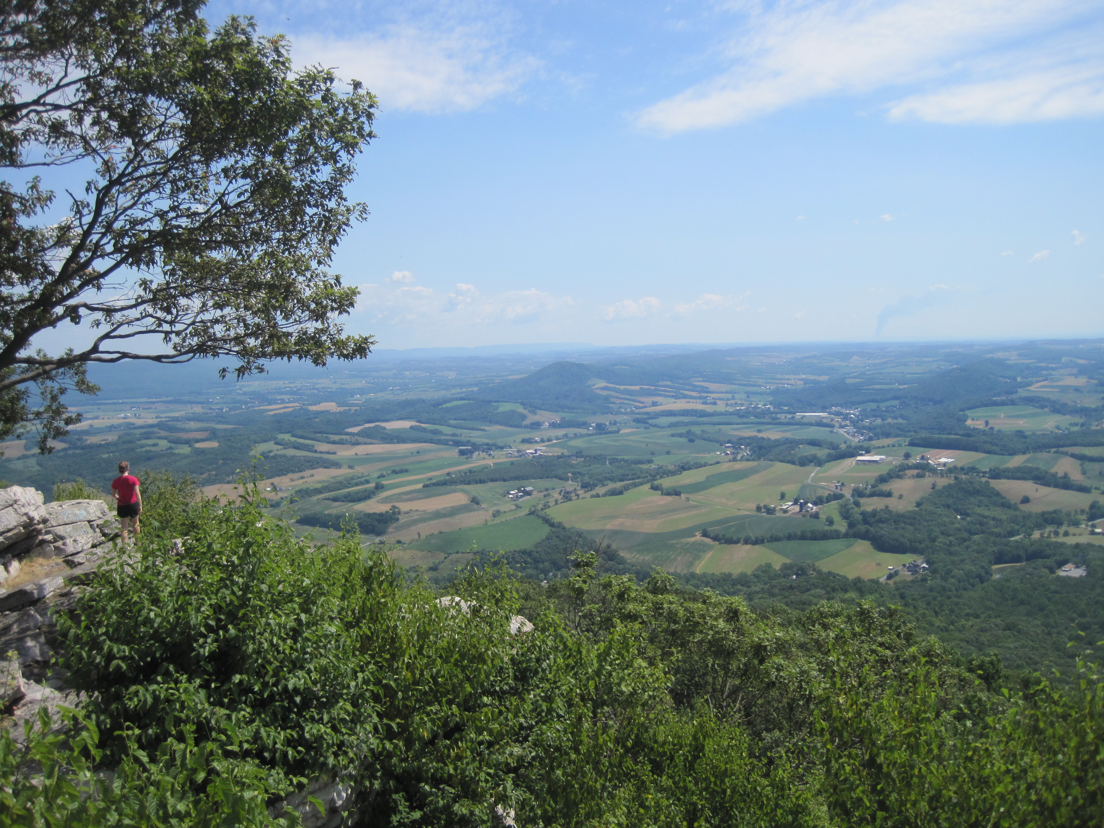
A new day indeed! A climb out of Port Clinton took us past some incredible views of Pennsylvania farmland from above – The Pinnacle and The Pulpit, to name two. Then onto Eckville Shelter, where we were glad to arrive early in the day to a cold shower and a relaxing afternoon. Like the 501 Shelter, Eckville is just off the trail, with a caretaker and running water – a welcome set-up for hot afternoons.

Day 95 Eckville Shelter to Bake Oven Knob Shelter (17 miles)

Today we hit some of those famous Pennsylvania rocks we had heard so much about. Boulder-hopping and balancing along the rocky “Knife’s Edge” ridge-line made our hiking a bit slower, but more rewarding. As long as you watch your step (and if you’re fortunate enough not to be on the exposed rock in the heat of the day), this kind of walking can actually be fun. We camped at a quiet campsite, a few yards away from Bake Oven Knob Shelter, where some guys had taken over and were setting off fireworks (less quiet).

Day 96 Bake Oven Knob Shelter to Palmerton, PA (7.7 miles)

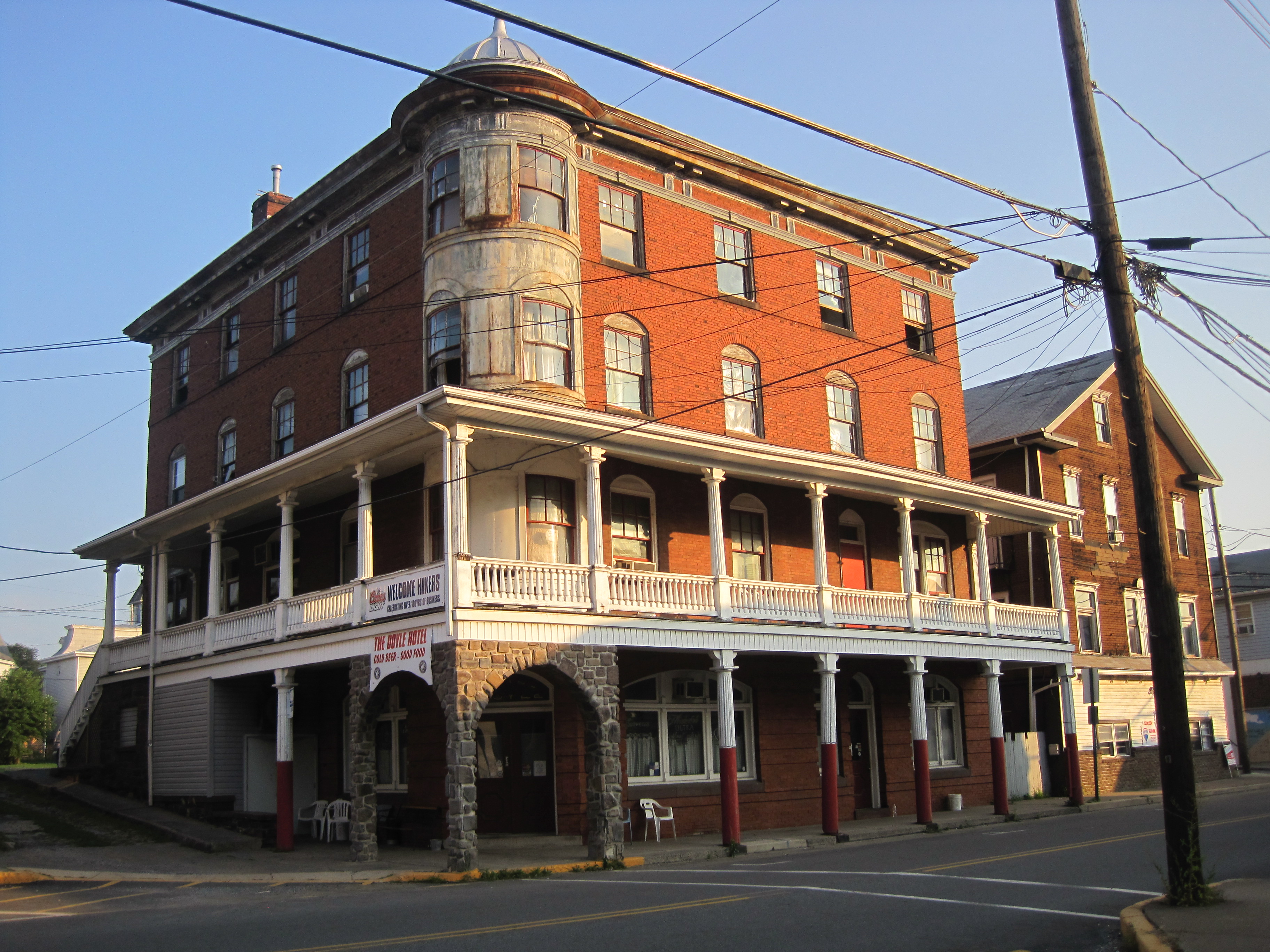
A short morning of hiking led us to Palmerton, PA, a wonderful trail town, featuring the so-called “Jailhouse Hostel.” It’s not actually a jailhouse but the town’s old municipal building, where they let hikers sleep in the basement bunk-room, free of charge! It was a hot day in town, but we were able to get some great food and enough ice cream to keep us cool on a 95-degree day (Claude’s Creamery – you are well loved).

The "jailhouse" hostel in Palmerton, PA.

The “jailhouse” hostel in Palmerton, PA.

Day 97 Palmerton, PA to Leroy A. Smith Shelter (16 miles)

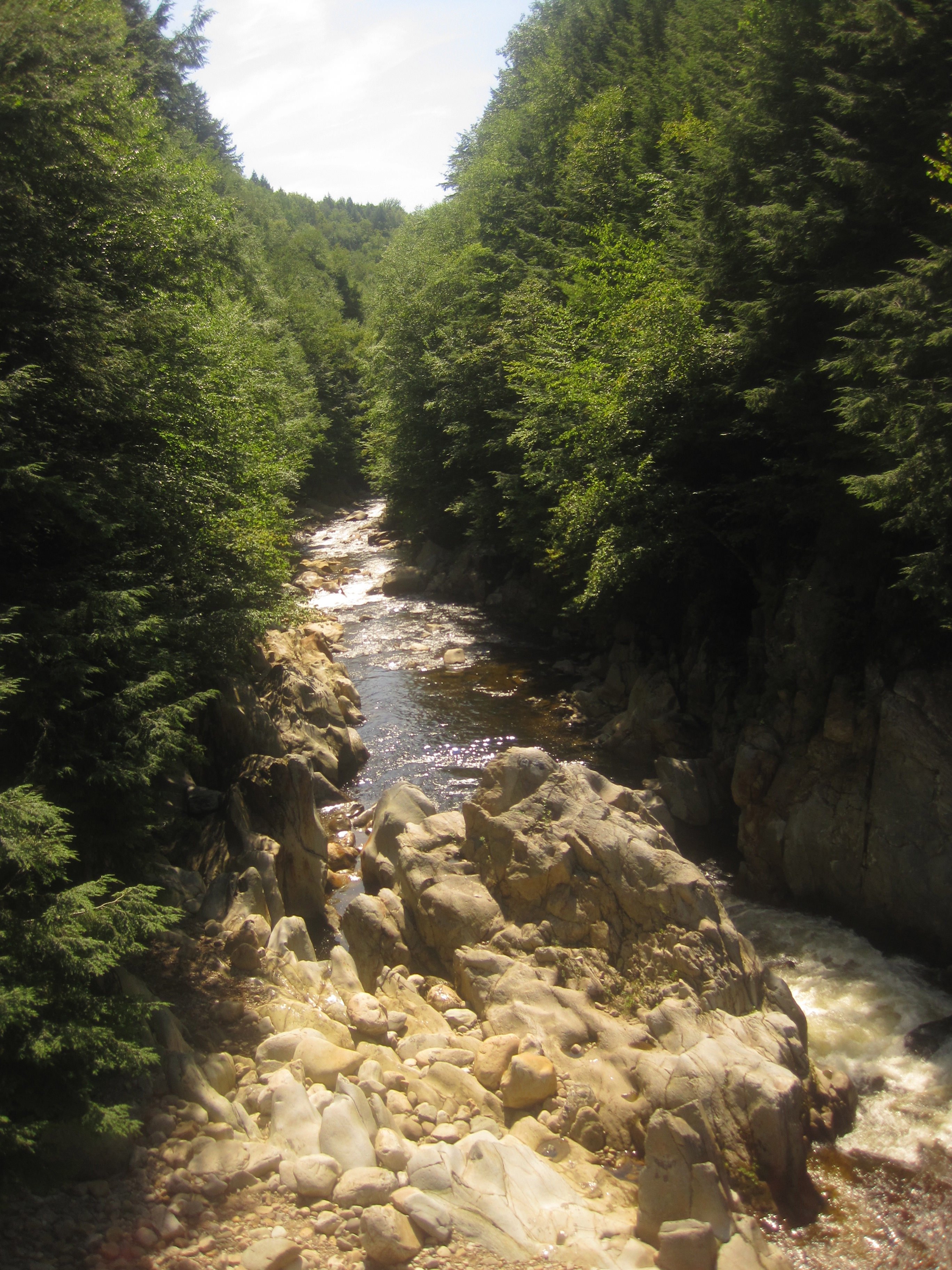
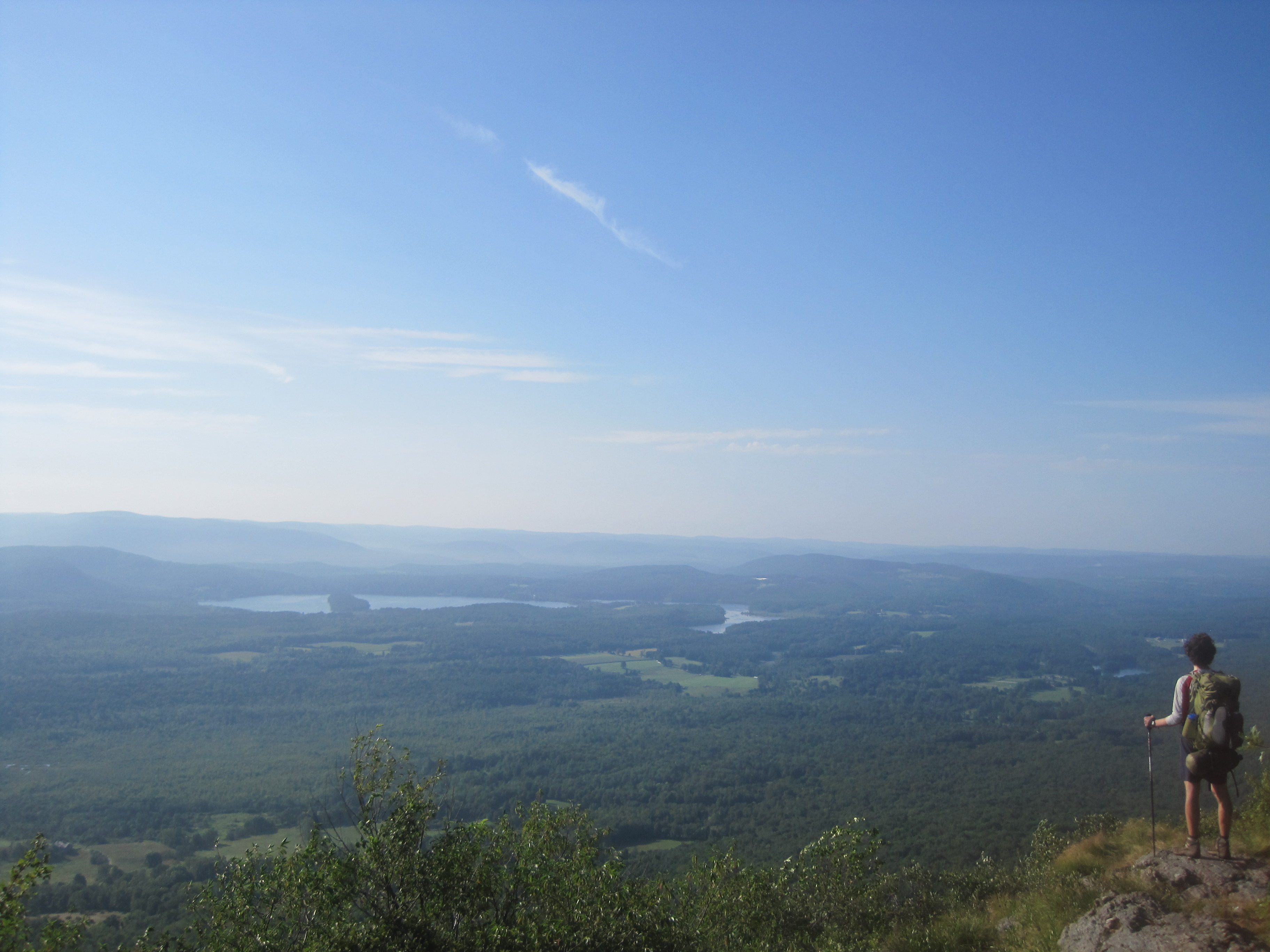
If you look at an elevation map of the Appalachian Trail, you might notice that north of Palmerton, PA the incline gets CRAZY for a good 2 miles. Commonly referred to as one of the hardest climbs on the AT, the trail leads you straight up a bald rock-face, where a zinc-smelting operation in the area left heavy metal residues, making it devoid of vegetation. The EPA closed the plant a few decades ago, and declared the mountain a Superfund site. Up we went over the “SuperFUN” site, as Zack likes to call it. And indeed, we actually did find it pretty fun, despite all the negative hype. We got out early, and were at the top of it by 6:15am, well before the heat of the day and in time for the sunrise over Palmerton. The rest of the day was flat and easy, and we made it to camp before 1:00pm, just in time for a nap!

The climb out of Palmerton, PA.

The climb out of Palmerton, PA.

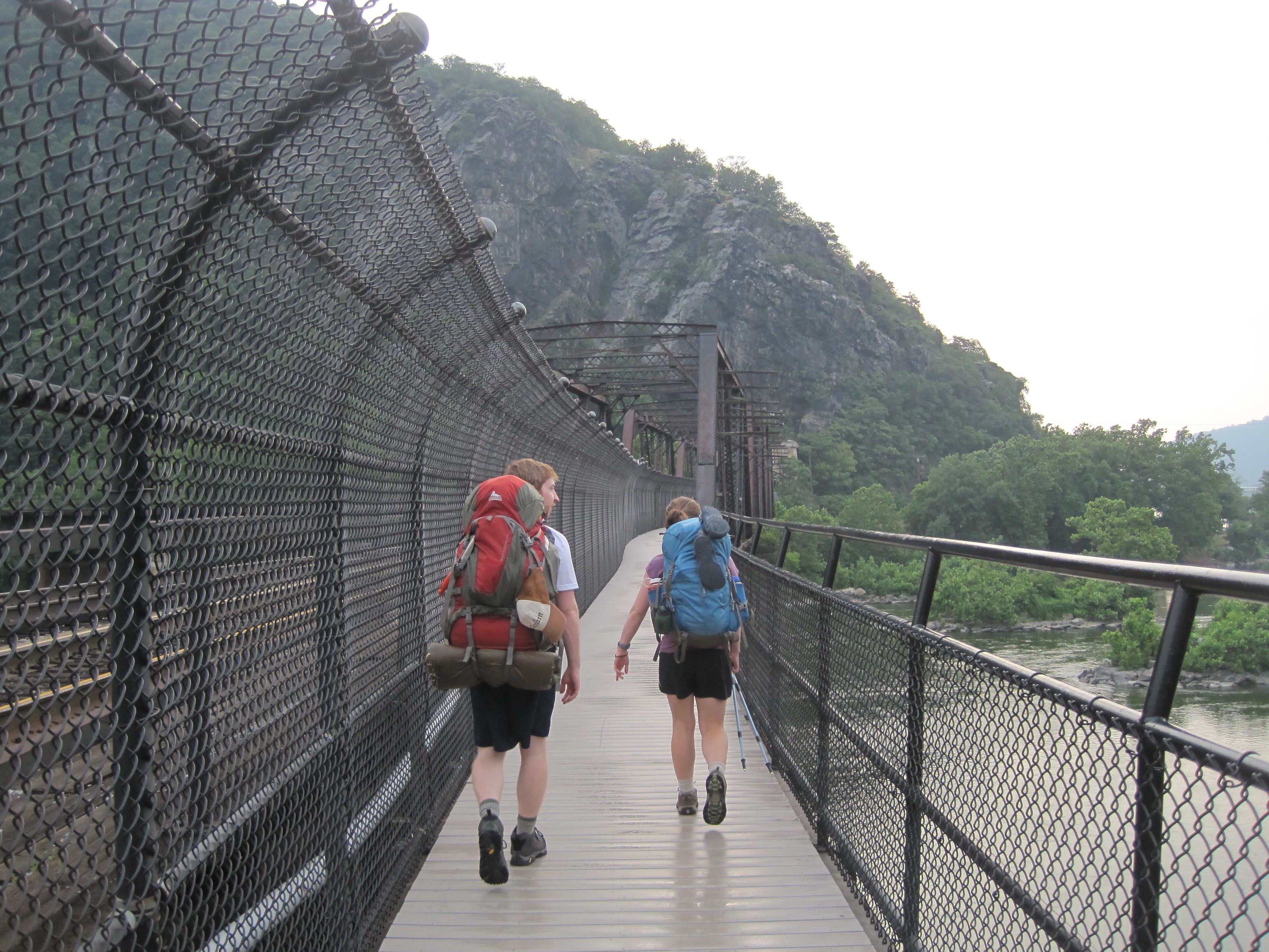
Day 98 Leroy A. Smith Shelter to Delaware Water Gap, PA (21 miles)

Today was our 7-year anniversary! Yay! To celebrate, we decided to get to Delaware Water Gap earlier than expected by tacking a few extra miles onto our hiking day. It was a long, hot day at the end of the 230 miles in Pennsylvania, which we ultimately decided we had thoroughly enjoyed. (Despite the frequent complaints about the state’s rocks and heat, we had generally mild weather and we thought the rocks weren’t as bad as they were made out to be. I had originally planned to include here a poem about my feelings on Pennsylvania – perhaps entitled “Pennsylvania Rocks!”- but decided against it.) We pulled into DWG by 3:00 where we checked into the Presbyterian Church of the Mountain Hostel for another night of incredible hospitality (the church opens its doors daily to smelly hikers). Yummy treats in a mail drop from our parents and an enormous banana split at the old-fashioned ice cream emporium in town rounded out the day.

Day 99 Delaware Water Gap, PA (0 miles)

The heat was picking up, and we were grateful to be spending most of our day indoors and not on the trial. We had a great lunch at the Apple Bakery and a leisurely afternoon of eating and sitting in air conditioning (when possible). Topped the day off with another enormous sundae at the ice cream emporium.

Day 100 Delaware Water Gap, PA to Mohican Outdoor Center (10.5 miles)

One hundred days on the trail today! Or…one hundred days since we started our journey, which includes the days we have taken full “zero” days. We celebrated by crossing the Delaware River and entering New Jersey! In what would begin a series of unfortunate events, I was feeling a bit nauseous, but I chocked it up to all the dairy (see: ice cream emporium) that we’d had in DWG. We took it slow on our 10-mile day, which was increasingly hot, but incredibly beautiful. We walked by the glacially-formed Sunfish Pond and enjoyed the Jersey ridge-walking. We arrived at the Mohican Outdoor Center in time for lunch, where we were able to rest in the shade and wait out the heat of the day before heading back to our campsite. I still felt a bit funny at the end of the day, but was able to eat and drink normally, so I figured with a night of good sleep, I’d be as good as new…little did I know what awaited us on Day 101!

Firetower near

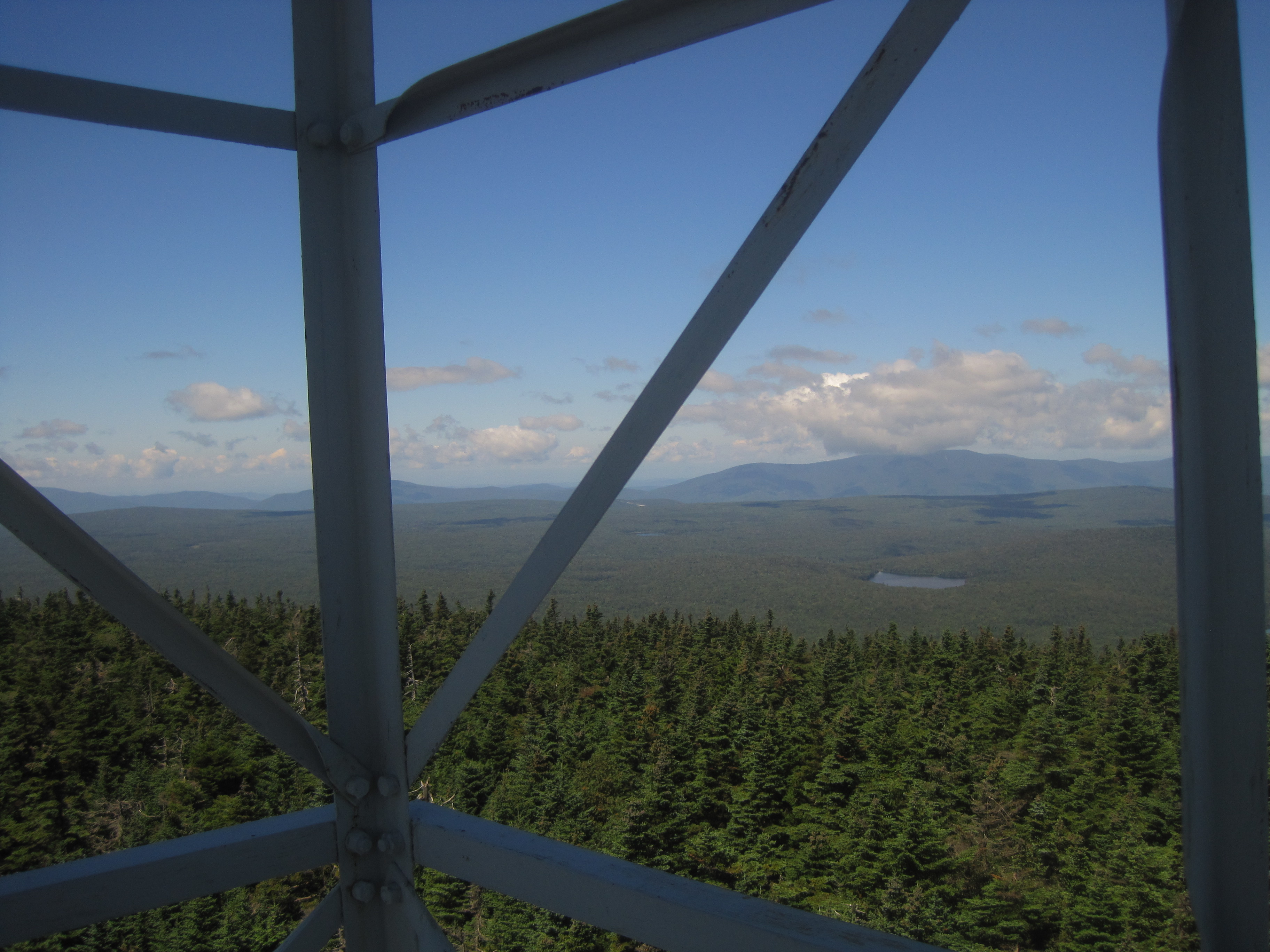
Fire tower near Rattlesnake Mountain, NJ.

Day 101 Mohican Outdoor Center to Rattlesnake Mountain (10 miles)

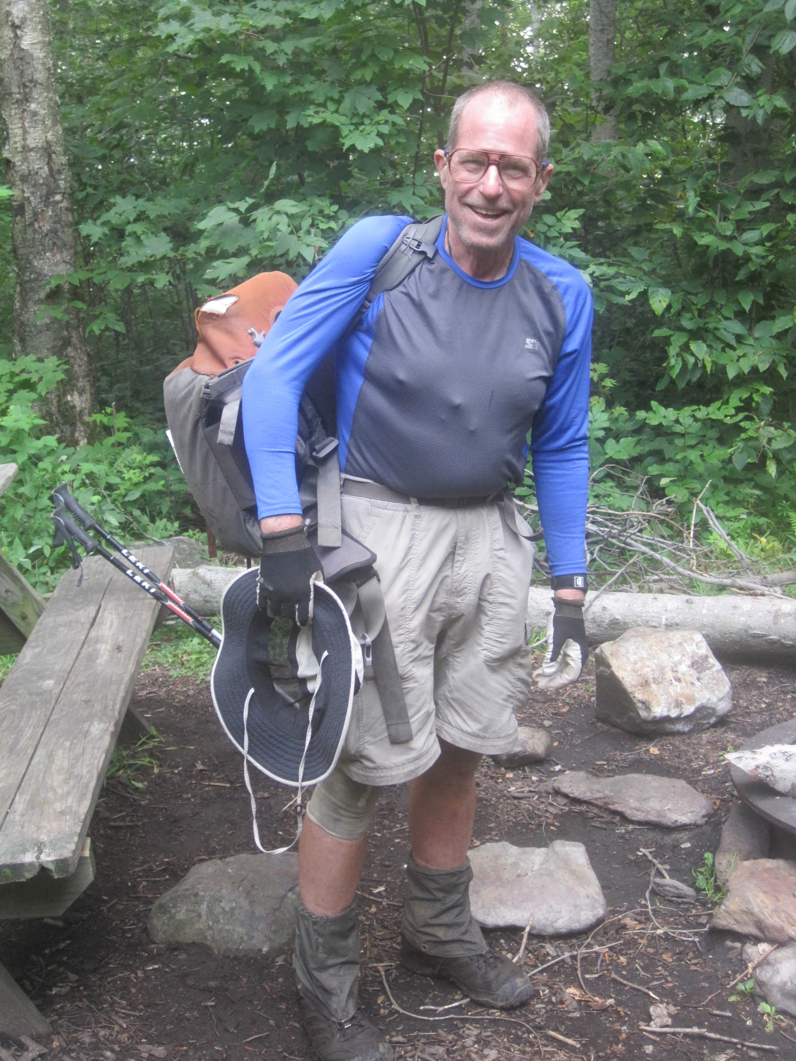
Thinking we could outsmart the heat that was expected to reach its peak today, we woke up at 4:00am and left the Outdoor Center by 5:00. We had sweat all through the night, as the heat hadn’t let up, and we were sweating within our first few steps on the trail. We caught an amazing sunrise from the top of a fire tower looking over the valleys below, and we pressed on, making good time, and thinking ourselves very wise for getting up early. Around 9:00, Zack asked if we could take a break because he wasn’t feeling very well. We ate a small, salty snack, drank water and pushed on. At 10:00 we stopped again. This time, Z was spent. Recognizing the signs of heat exhaustion, we found a shady spot on the trail and tried to rest. I don’t want to go into too much ugly detail, but I’ll say that once the vomiting started, we knew it was time to call 911. Since we were in the woods, a good six miles from the nearest paved road, it took a few more hours of trying to keep Z cool, resting and hydrating before the first ranger showed up, followed by a very friendly EMT and his helpers. They surrounded Z with ice packs to bring his body temp down, and in time, he was able to gain enough strength to walk out the mile to where the ATV waited, ready to escort him to an ambulance. Once we boarded the ambulance, we were taken to Newton Hospital, where he was hooked up to an IV, and got some color back into his cheeks. It was then that I started to feel funny, and my feelings of nausea from the last 48 hours – which I must have suppressed in the adrenaline rush of making sure Zack was going to be OK – came back with a vengeance. I thought I’d ask the nurse about it, and in the middle of my questions, it was my turn to vomit…not a lovely story, I know, but looking back, the timing could not have been better. I was already in the ER, the safest place I could be, so I signed in, and then it was my turn to get an IV. My first time in an emergency room, and my first time in a hospital bed! What a day.

The rescue team.

The rescue team.

Since our misadventures on Day 101, we have been hanging out in Branchville, NJ resting and trying to get some food and water back into our systems. I had one more bout with the nausea after leaving the hospital, but Zack has been solid as a rock since. Three full “zero” days here (Days 102-104), where we have been joined by Zack’s “Uncle Danny,” who drove us around and helped us find unlikely sources of air conditioning (why not spend an afternoon at ShopRite?) and kept us great company. Now that the oppressive heat wave has broken, we are excited about getting back on the trail tomorrow and easing ourselves back into the swing of things.

We are so grateful to the wonderful people who have helped us out (including MaryAnn, who gave us a ride to the library today to keep us from going stir-crazy), and we’re glad to have made it 1,300 miles without too many hitches. We were due for one, I guess!

Less drama next time, we promise.

Love and happy trails,

Lara (and Zack)

Pennsylvania

Posted on July 13, 2011

I’m writing from Bethel, PA. We’ve just resupplied at a Mennonite discount store thanks to a tip (and a ride) from Bob, the caretaker at the 501 shelter up closer to Pine Grove. The store was packed at 3:00 on a Wednesday! Guess that answers the question of when the entire town of Bethel does their grocery shopping. Since we last blogged from D.C. we’ve completed two more states: West Virginia (itty-bitty mileage there) and Maryland (not quite as bitty). Friend Colin joined us for most of his home state of MD, and even resupplied us by the side of the road a day after we parted ways. Never thought I’d be able to eat a piece of cheesecake in 90 degree weather and then continue hiking, but, with Colin’s help, we made it happen. Still working on his trail name, though Tenderfoot the Tenderfooted and O’Sheanendoah are in the running.

We’ve probably heard more opinions about Pennsylvania than any other state (save maybe Virginia), most of them negative. Granted, most of the state is flat as a pancake and littered with rocks. A native commented to us, “yes, it’s rocky, but at least we’re nice!” Nice they are.

Hello, Pennsylvania!

Hello, Pennsylvania!

It’s all about perspective and mental fortitude at this point in the game though, and, with only about 2 months of hiking left, we’re doing our best to make the most of it. Our journey has taken us by old mining towns, behind hedgerows, through cornfields and into some brilliant little towns. PA, you’re A-Ok!

On a side note, I’ve started pinning down birdsongs. There’s one bird whose song is the first few notes of “On Broadway,” and another who sings “I barely learned the tune” from Simon and Garfunkel’s “So long, Frank Lloyd Wright”–ornithologists, please chime in.

Here’s the lowdown:

Day 83 Town’s Inn, Harpers Ferry to Rocky Run Shelter (15.4 miles)

Hiking out of Harpers Ferry on July 4th with Colin in tow. An easy day out of the gate after our relaxing visit to l’otel Boyd in D.C. Meandered along the C&O towpath, spotted nice views of the Potomac and the Shenandoah rivers and spent the night at a gorgeous new shelter.

Day 84 Rocky Run Shelter to Raven Rocks Shelter (20.6 miles)
Our first and only full day in Maryland. We climbed to the top of the original Washington Monument (circa 1827), but our view of the surrounding area was obscured by fog. Still, grabbed a great photo of Colin inside this bottle-shaped tower. Due to rocks, heat, and blistered feet, Colin called it a trip late in the day. We miss him!

Veggie and O'Sheanandoah.

Veggie and O’Sheanandoah entering Maryland.

Day 85 Raven Rocks Shelter to Rocky Mtn. Shelter (19.8 miles)
Craggy descent this morning as we sped toward the Mason-Dixon line and into PA. If you’re looking for an introduction to the Appalachian Trail, give yourself 4 nights and take on Maryland: the terrain is gentle, water can be found at numerous state park spigots and history abounds.

Day 86 Rocky Mtn. Shelter to Toms Run Shelters (19.2 miles)
Made the mistake of sleeping in a small shelter at Rocky Mtn. Turns out the structures do a pretty good job of keeping heat in. We waddled sweatily to the next shelter just in time to beat the rain. Met several hikers pushing on to Pine Grove Furnace State Park to attempt the half-gallon challenge (more on this later) but decided to hold off until we were nearer to indoor plumbing.

Day 87 Toms Run Shelters to Allenberry Playhouse, Boiling Springs, PA (23 miles)
Passed the half-way point today! Met a few former thru-hikers–Blue and Evergreen–who made us sandwiches and let us huddle under their tarp while a downpour set in. Really looking forward to repaying all this trail magic someday. Since we were soaking wet and desperately in need of a shower we decided to push big miles into Boiling Springs. A fellow at the ATC regional office there let us in on a secret: the Allenberry Playhouse and Resort offers rooms to hikers for $40, well below their usual rate. We pounced on the deal, and while we had to skip the production of “Hello Dolly” (next time!), we had a great time exploring the tiny town.

Day 88 Boiling Springs, PA to Cove Mt. Shelter (21.5)
Began the day with a 12-mile walk through backyards and farmland. I had had some anxiety about this walk for some time because of the level of exposure to sun it carried. Fortunately we were able to get an early start and beat the heat. Met a swell section hiker, Reid, and his scrumptious dog, Goose, at Cove Mtn. He’s hiking southbound so we were able to offer him some useful advice. Nice to talk trail with someone who isn’t as immersed as we are.

Day 89 Cove Mt. Shelter to Doyle Hotel, Duncannon, PA (4.1 miles)
Strolled down the mountain into Duncannon this morning, caught a ride to the grocery (thanks Timone!) and commenced the half-gallon challenge. An old AT tradition, the challenge–eating a half-gallon of ice cream, unassisted, in one sitting–commemorates the passing of the half-way point. My strategy? Neapolitan ice cream. Completed the challenge in 33 minutes and didn’t lose any of it. In fact, I went about eating as usual for the rest of the day. That’s a hiker appetite!

In other news: “Billville,” a generous group of AT enthusiasts, had thrown a “hiker feed” here two days prior. Lots of folks we hadn’t seen in a long while hitched forwards or backwards to attend, so we were overwhelmed by a spontaneous reunion of sorts. The Doyle Hotel, over 100 years old, has become a must for thru-hikers. Not the best accommodations we’ve ever had, but the food was good and the people were super.

The (in)famous Doyle Hotel.

The (in)famous Doyle Hotel.

Day 90 Duncannon, PA to Peters Mtn. Shelter (11.2 miles)
Easy day out of town. Started with a huge breakfast in town and then onto our longest highway walk yet, over the Susquehanna, which was full of cobwebs. A train came along the tracks just as we were leaving town, and we got a pretty cool video of it. An early day into the shelter, and a hot afternoon.

Day 91 Peters Mtn. Shelter to Rausch Gap Shelter (18 miles)
Walked through an old mining community today, so we hear. Saw a bear, thinner than the ones we saw in SNP. Guess there are fewer pic-a-nic baskets in central PA. Camped in a gorgeous spot by Rausch creek that reminded us why we’re out here.

Day 92 Rausch Gap Shelter to 501 Shelter (17.5 miles)
Battled gray skies and unchanging terrain this morning but persevered! Looking forward to our night at the famous 501 Shelter, an old potters studio complete with bunks, a solar shower, and a skylight. Really enjoying the opportunity to stop by so many towns in PA. These are definitely places we never would have made it to otherwise. Shout out to George, Kathy, Chip and Gillian–we’re right near your old home of Reading!

We’re likely going to “zip” through a few states in the next few weeks. Meeting up with Mama and Papa E. in NYC in no time!

Love,
Zack (and Lara)